Landslide Research, News
Landslide Research, News
Landslide Research, News
Preliminary Sensor Installation is a Success
Summer has already been a time of many milestones for landslide research in Sitka. Our first high elevation weather station is up and running with real-time data collection rolling in this fall. Data receiving antennas were installed at the both the Sitka Ranger District building and the Sitka Police Station that will receive data from soil moisture sensors. It’s likely you’ve been hearing mention of these soil moisture sensors, so here’s the detailed scoop on them.
In Sitka, landslide initiation seems to be largely dependent on the relationship between rainfall intensity (amount of rain over time) and rainfall duration (how long it rains for). Thanks to the new high elevation weather station from DGGS, we can monitor that relationship better than ever before. What it doesn’t show us, however, is how the soil is responding to rain on a microscopic level.
Soils 101
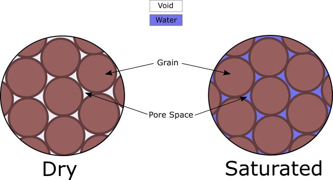
Soils are made up of grains, or pieces of rock and organic material left after weathering (the breaking down of rock) over an extended period of time. As these grains pile up to make a soil, they leave empty (or void) space between them which is referred to as pore space. Rain can fill up this void pore space causing a soil to become saturated and in turn increasing the soil’s pore pressure (pressure of water held within the soil). A high pore pressure pushes the grains apart resulting in a less cohesive soil, thus more prone to failure. With this in mind, it is clear that moisture and pore pressure are soil properties that need to be carefully monitored in certain types of rainstorms.
Monitoring
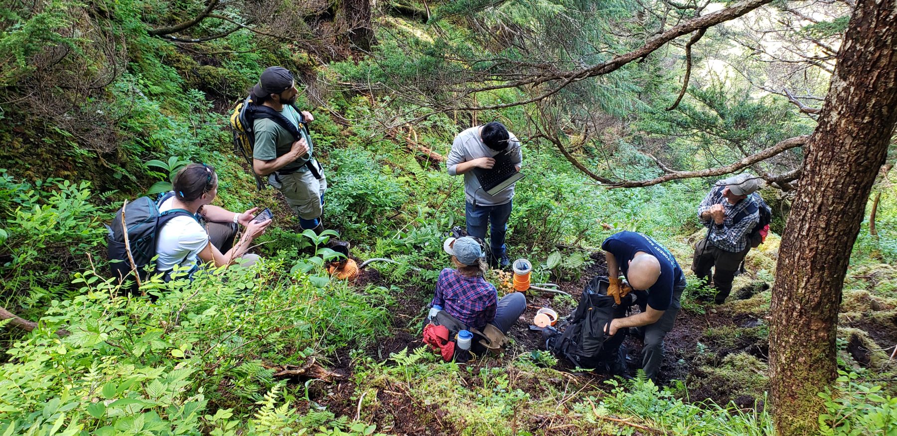
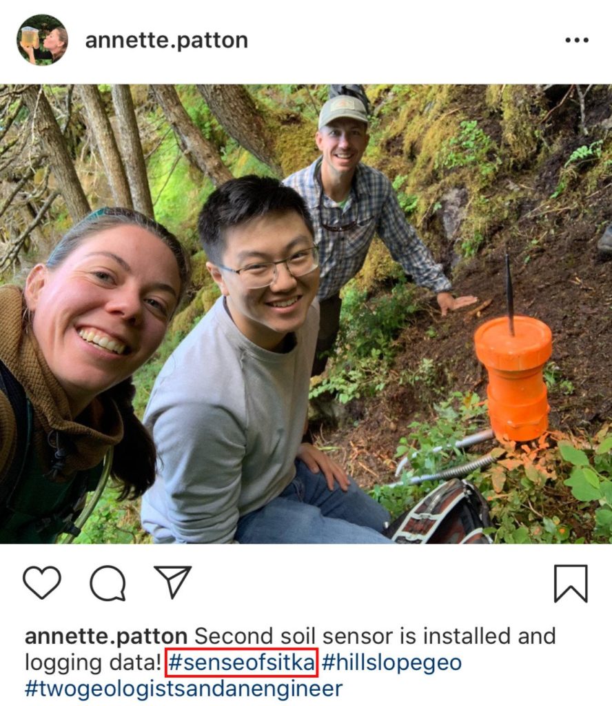
To monitor our soils, a low-power, low-cost sensor was designed that can withstand the rain and wind we experience in coastal southeast Alaska. A team from Oregon State University’s OPEnS Lab, managed by Dr. John Selker, Dr. Chet Udell, and Dr. Cara Walter, excitedly took on the job and created the sensor you see below. Students Bradely Best and Max Chu from OPEnS Lab joined us in Sitka this summer for the preliminary sensor installation.
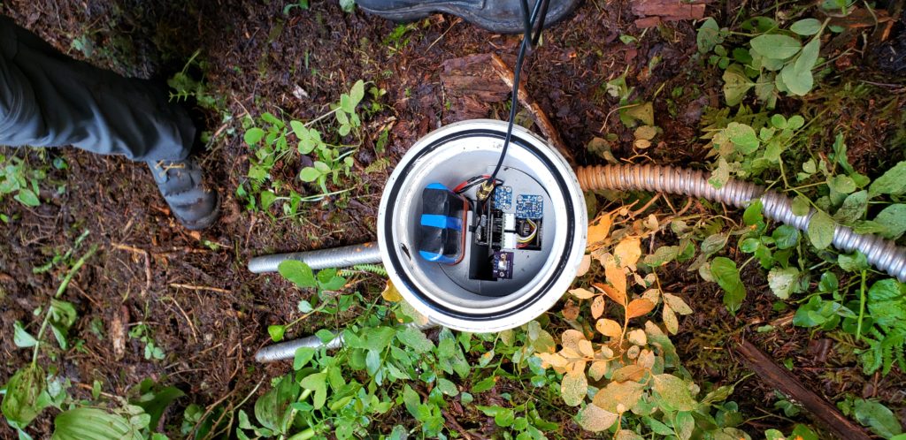
Top down view of sensor brains. 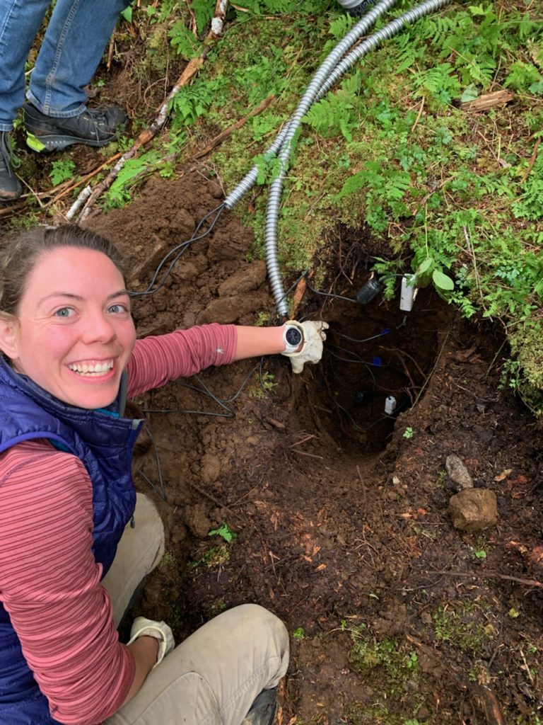
Dr. Annette Patton installing soil moisture sensors at appropriate depths. 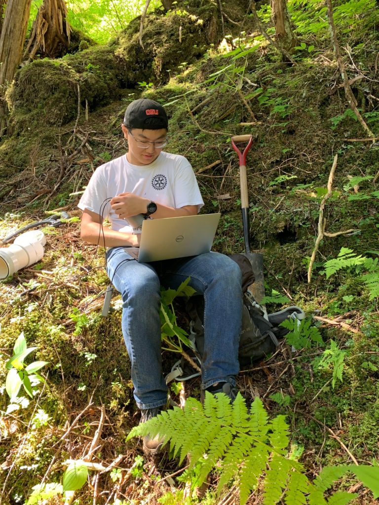
Max Chu with OPEnS Lab getting a sensor up and running. 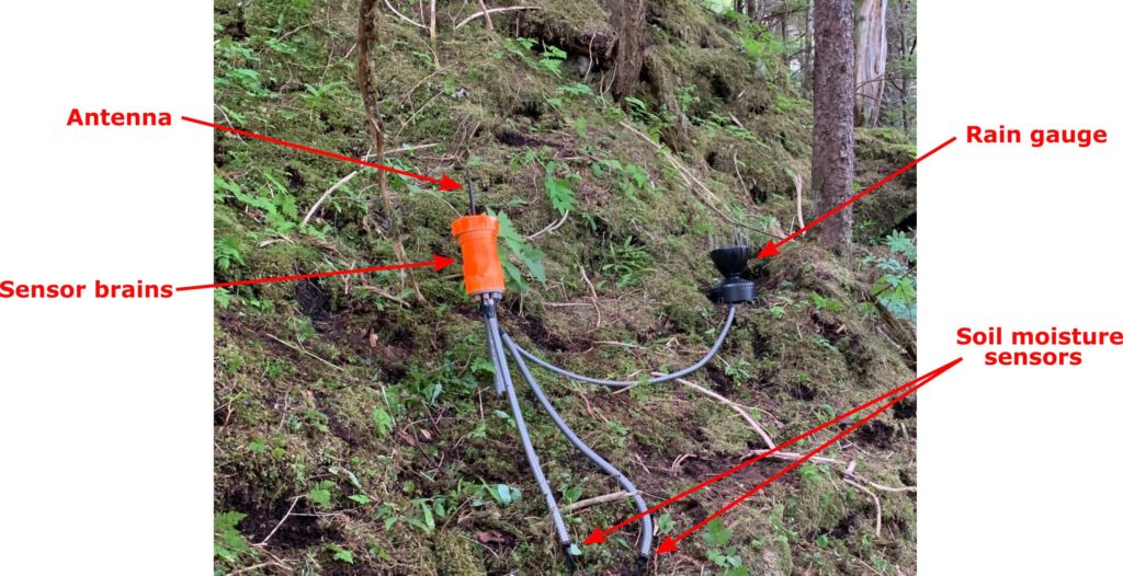
These sensors can also monitor pore pressure and acceleration (in case the land moves). There are currently three sensors installed, one on Harbor Mountain, one on Gavan Hill, and another on Mount Verstovia; they will run for at least the next few months while we learn how to improve sensor design and tailor them to Sitka’s environment.
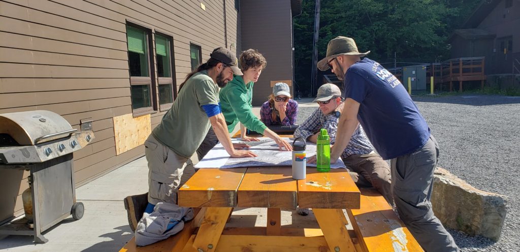
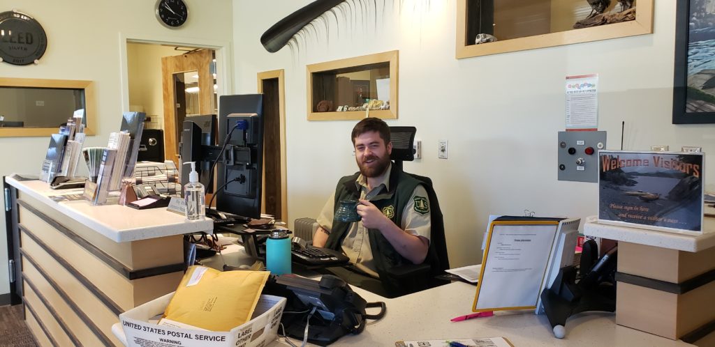
We were thrilled to have USGS employees Ben Mirus and Corina Cerovski-Darriau and National Weather Service employee Aaron Jacobs along for this installation, their support is going to be crucial for the success of this multi-agency work. Additionally, this field season wouldn’t have gone as smoothly as it did without the local expertise of US Forest Service (USFS) employees KK Prussian and Jacquie Foss, or the enthusiastic greeting, calling, and door opening skills of the USFS’s very own Riley Whitson.
Jacquie Foss discusses sensor locations with members from UO, NWS, and USGS. 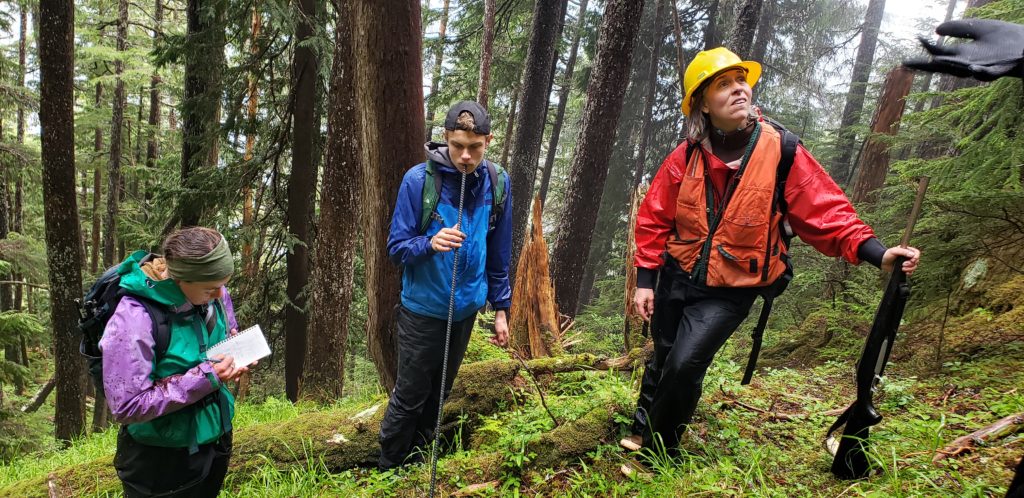
KK Prussian (right) helps scout sensor locations.
How can I help?
We understand that in a town of outdoor enthusiasts, people are bound to encounter these sensors as they use the forest. In the event that you run into one, take a selfie with it! Use the hashtag #senseofsitka and post it to social media to help us identify maintenance needs, see how the environment around them has changed, and raise awareness about their purpose and project goals.
As the warning system becomes more developed, volunteer opportunities such as maintaining and monitoring hardware will arise. If you are interested in participating in the development of this work, please contact us!