Landslide Research, News
Landslide Research, News
Landslide Research, News
Researchers Will Map Social Connections in Sitka to Improve Landslide Preparedness and Warning
We’ve had a productive summer of installing soil moisture sensors and a weather station that may enhance our understanding of when landslides occur. While crucial elements to a landslide warning system (LWS), these sensors aren’t the only things that will make a LWS successful. Even if we get to the point where we can predict landslides, it is only useful if we can communicate risk to those living in landslide prone areas. A team of social scientists are involved in this aspect of LWS development and are working to understand how messages travel through Sitka’s social networks so landslide preparedness information and specific landslide warnings can be received by residents who need them the most.
Social Networks 101
Social networks are everywhere. All of the ways that we connect with each other – whether through talking face-to-face, connecting on Facebook, texting, or even marine radio – form social networks. In the event of a natural disaster, social networks allow first responders to connect with each other and with affected citizens. They allow neighbors to warn each other and take action to help each other – such as providing a place to stay or sharing transportation out of harm’s way.
Social network research is used to identify parts of a network that might need special attention during a natural disaster such as a landslide. By collecting surveys and assembling the results, social network research can identify “isolates,” or individuals who are not well connected to the rest of the group. For example, a survey might ask Sitkans to list the first 20 people who come to mind who are: (a) likely to pass on information about landslide risk, or (b) likely to provide a place to stay in case of an evacuation. By compiling the results of many residents, research can identify specific types of individuals who have (a) less connections that would help them learn about landslides, or (b) less opportunities for shelter during an evacuation.
In Sitka, an “isolate” might be an elderly individual who has just relocated to Sitka from elsewhere, an individual living “off the grid” and away from the reach of cell phone towers, or someone with a vacation home and not integrated into the community. Such individuals may need extra outreach to ensure preparedness for landslides while assuring that warnings are received and resources are accessible during periods of high landslide risk or evacuations.
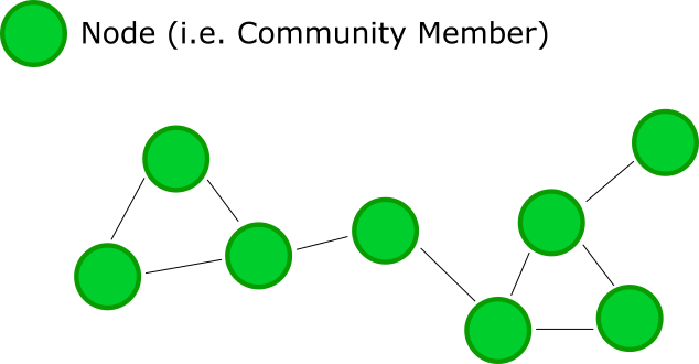
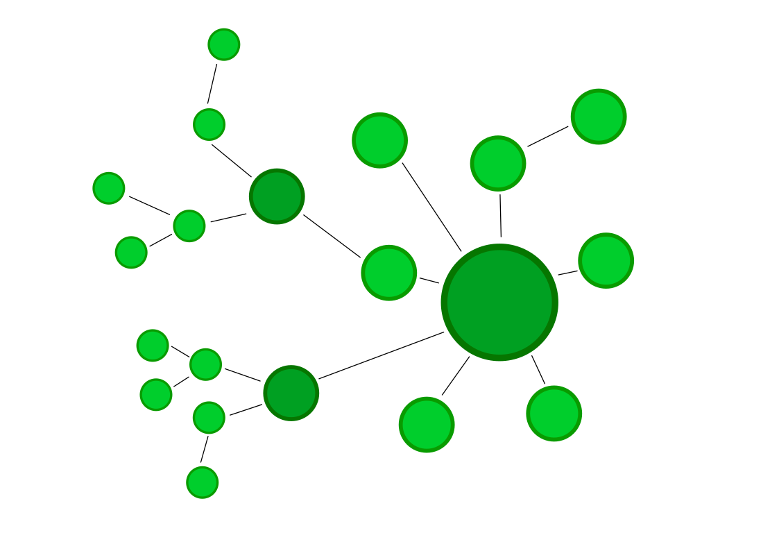
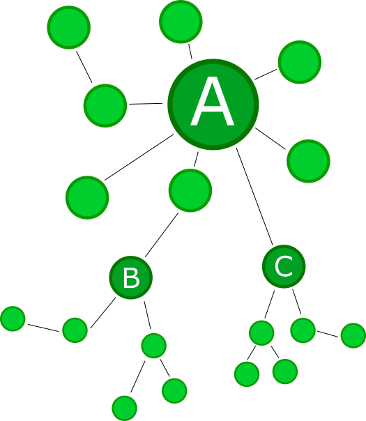
Individuals in a social network (represented by the green dots above) are called “nodes.” Social network research also identifies individuals who are well connected with others, a characteristic known as “high centrality.” These “high centrality nodes” (such as A, B, and C below) can be particularly effective in helping others to learn about, prepare for, and respond to landslide risk and warnings because they are able to quickly reach a large number of other citizens through their existing connections.
Social Science Research in Sitka
The research team has been speaking with Sitkans to learn what types of groups or individuals might be more isolated (i.e., “isolates”) or well connected (i.e., “high centrality nodes”) in Sitka – as well as to understand how Sitkans communicate with each other about landslide risk whether it be through Facebook, the news, or a friend.
Senior Social and Behavioral Scientist Ryan Brown and Assistant Policy Researcher Max Izenberg from the RAND Corporation will be returning to the Sitka in late Winter of 2020 to conduct more formal survey research. Using a platform called “Egoweb” designed for social network research, they will be administering surveys on phones and tablets throughout the community. Results from these surveys will aid in designing a landslide preparedness campaign and a landslide warning system that reaches as many Sitkans as possible – and also reached those who might otherwise be cut off from typical information channels.